Mid Winter Alpine Gravel Adventure 2021
This particular trip had been on my mind for a few years on and off. As with most of my trips it all started with a late night session pouring over a NZ Topo50 Map (think Ordnance Survey Maps) These days this is very much a digital exploration, with paper maps primarily saved for getting beta on some forgotten tracks explored by Dad years ago or as a treat around a warm fire.

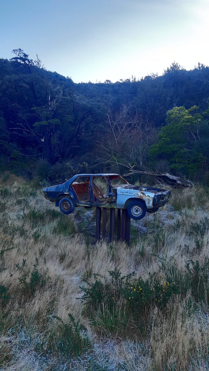
Any who back to the trip… I’d been looking over a particular part of the sub-alpine area a few hours drive from home. There were a number of track marks that followed the now famous Trans Alpine Railway (Christchurch to Greymouth through New Zealand’s southern alps) One day I’d love to take the train on this journey but this adventure was all about the bike.

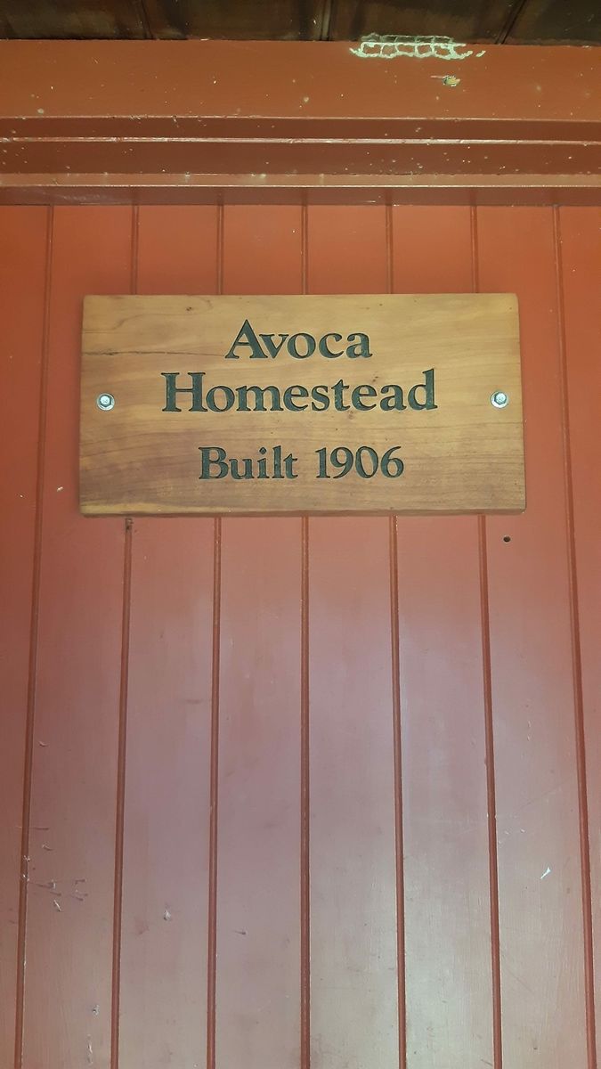
There is a well travelled path from the main alpine high down into a shaded valley all the way to an old homestead called Avoca. Once a remote, and likely freezing working farm grazing sheep and cattle, now it’s part of the nation wide government managed Doc Hut’s program which manages over 400 huts that the public can stay in.
From Avoca homestead the main trail runs out and a number of surveyed tracks are marked in the area. With some back and forward between layers on my Topo Maps app, aerial photos and Historical Right of Ways, it showed there was once a track that shadowed the main trunk line all the way back to the Canterbury plains (where I live) presumably built to create or maintain the train line itself…

It was about now that this trip got side tracked and forgotten about (as a lot of my trips do!) with other trips and life getting in the way. I think part of the problem was there were some logistics to solve before even getting to the “is there even a track there?” problems. With a lot of my trips being solo adventures and this particular trip being about 50km’s one way mainly downhill with a return journey with 2 significant passes on a busy highway. It really required a car shuttle which seemed too much admin for me =)


But as is generally the way after years of thinking about the trip on and off and once getting very close to just doing it solo over a long weekend, all it took was a friend to walk into the shop one Friday evening and mention he too had been thinking of a similar trip. With a quick relook at the map and a rough plan to meet on Sunday morning. It was all go. By Saturday night Richard had arranged another local mate of his to drop us at the start (avoiding the massive return leg) and we decided to meet nice and early to give us all day to explore.


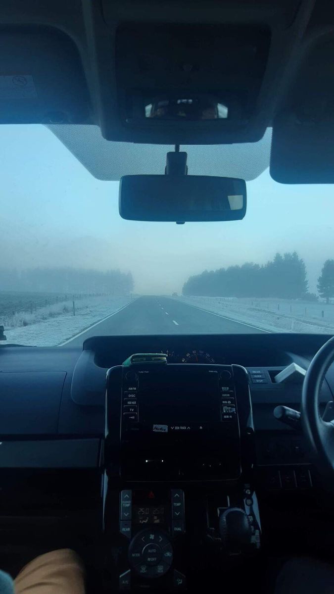
I forget the exact time we met but I think it was 6am. It was mid Winter but this morning was the first major frost so far. The air was fresh but not particularly cold at sea level. After the windows had been defrosted we were on our way and soon out of town on quiet dark back roads. Just after 7am the sun started to rise and we collected our shuttle driver Daz. He lived in Springfield where we planned to finish the ride so all going well we’d see him sometime that afternoon.
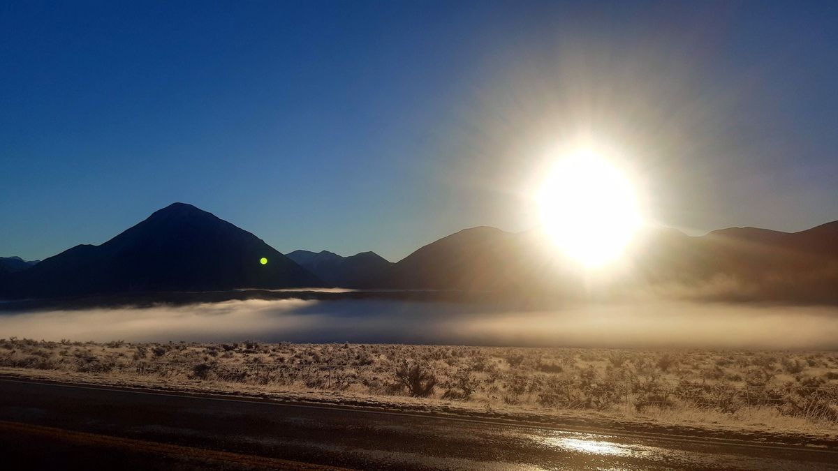
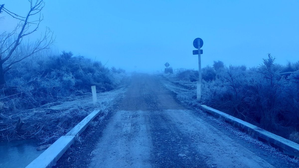
Daz worked at one of the local Ski Fields and had some good Beta on the areas we were heading to. He’d ridden from either end but never connected the dots. With the sun now just high enough to shine over the tall snow capped peaks we stopped on the side of the highway where our gravel road turn off started. The temperature outside read -8 c. I wasn’t particularly worried as we had stopped in a low valley blocked by a high peak and with low fog the heat just couldn’t get in.


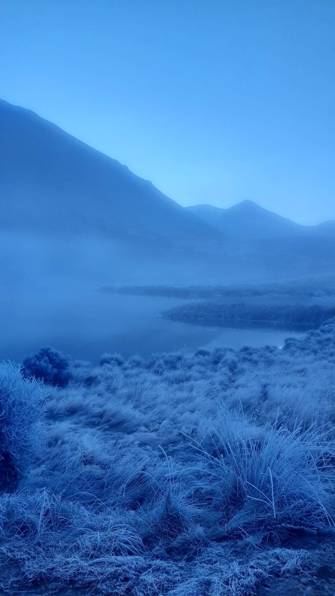
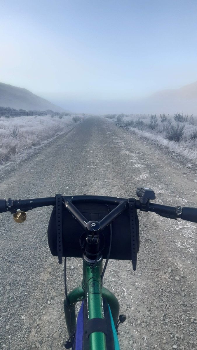
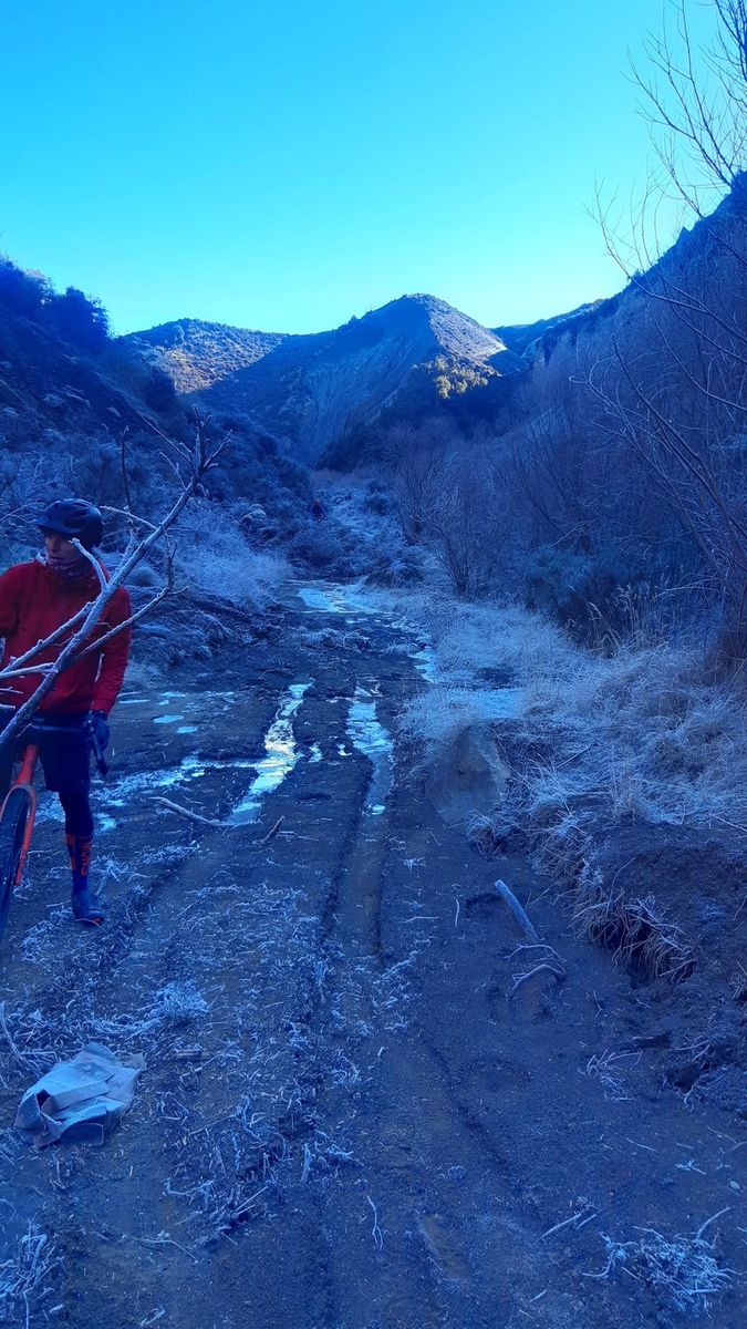
Soon we’d be down the road and around the peak with the snow blasting us with heat. Some last minute bike faff (there seems to always be a tyre to inflate a little more or a chain to lube) We waved good way to our driver Daz and the three of us started riding down the dark blue tinted foggy valley. We made it about 50m before Richard was off the bike and taking pictures (a sign of things to come) About 4km’s down the valley we dropped down a short descent (maybe 50m vert) once at the bottom both my drink bottles had frozen solid (there was liquid at the top) now they probably weren’t actually solid but you couldn’t squeeze them and no liquid would come out. At this point we had stopped beside a small creek and 2 old railway houses (now holiday baches)
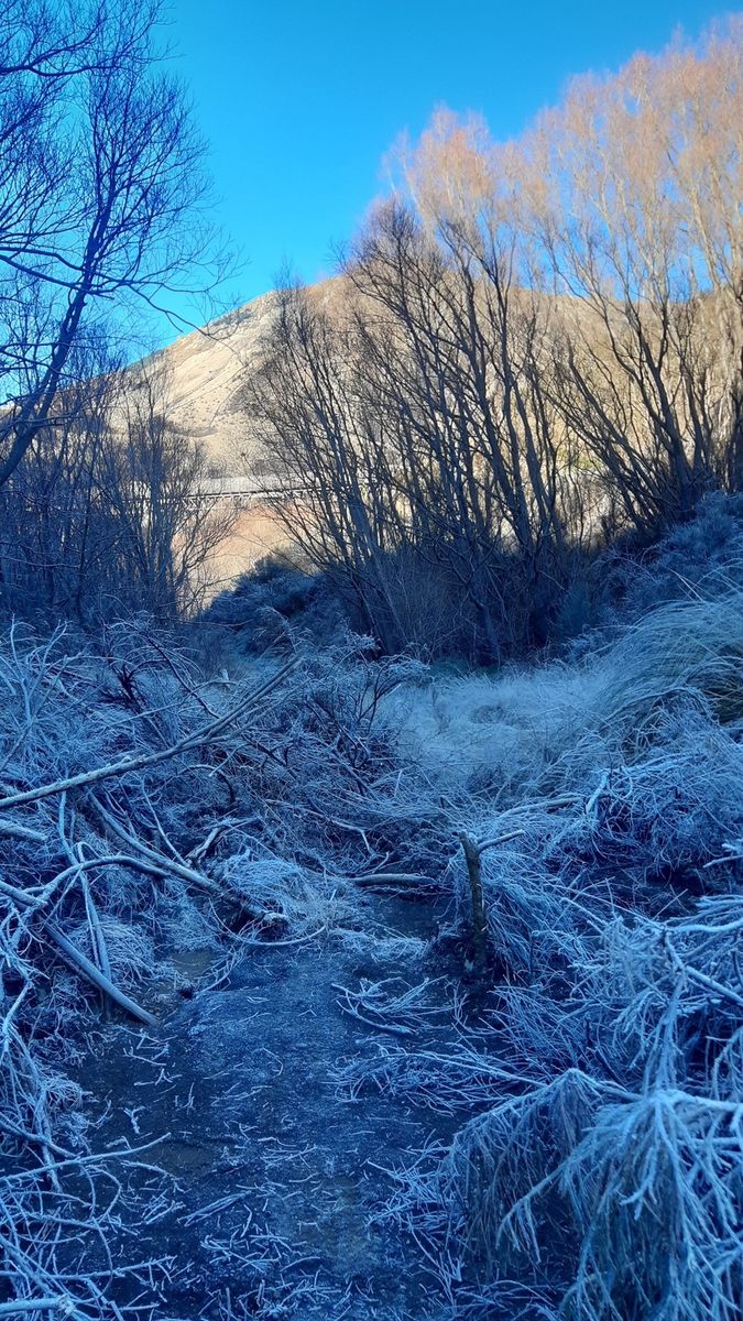

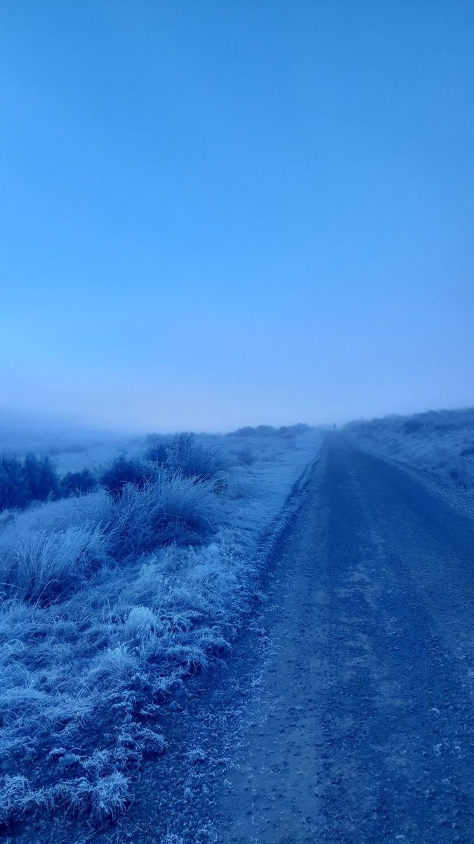
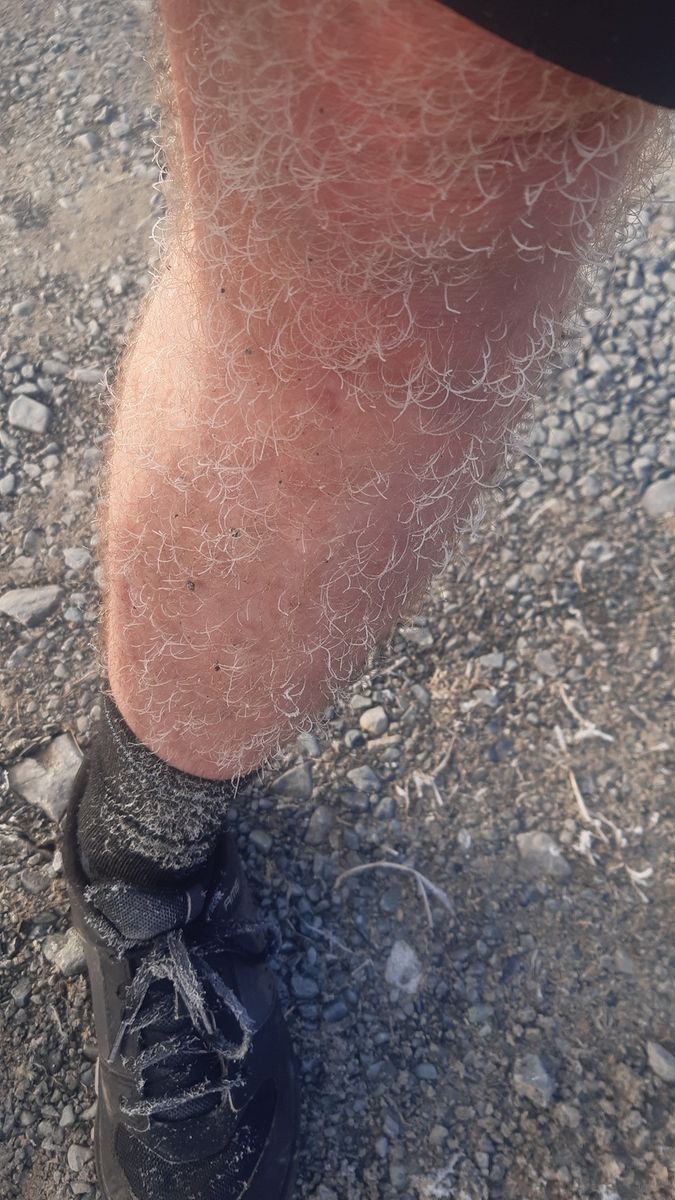
The thick fog had been keeping the sun out for days and the ground and trees were frozen solid. At this point I was starting to feel the cold. My two riding buddies were in pants or knee warmers, had a couple of layers on and were still looking frozen, I was wearing what I always wear, wool socks, shorts, merino thermal, wool top and my jacket, and honestly the main issue I had was I couldn’t feel my toes! I’ve been to some bloody cold places but in that moment I had wished I’d packed a second pair of socks. The hairs on my legs had frozen and felt like you could snap them off, the guys couldn’t believe I wasn’t cold in my shorts but all I wanted was another pair of socks. With photo’s taken and banter about how cold it was done, we continued pedalling down the road, and after a few more foggy km’s and the odd gate we soon crested a small hill and rounded a bend to be bathed in sunshine.

I think the mercury went up 20 degrees in those few km’s from surely minus 10 to +10c. With this new found sunlight came some absolutely amazing scenery the frost on some of the plants and fence wire was an inch thick and the morning light made it shine like a high polished NOS dura ace hub :-D
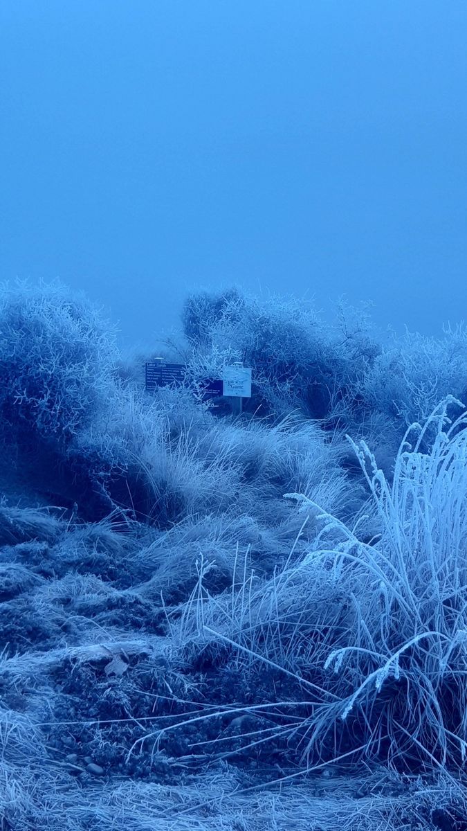
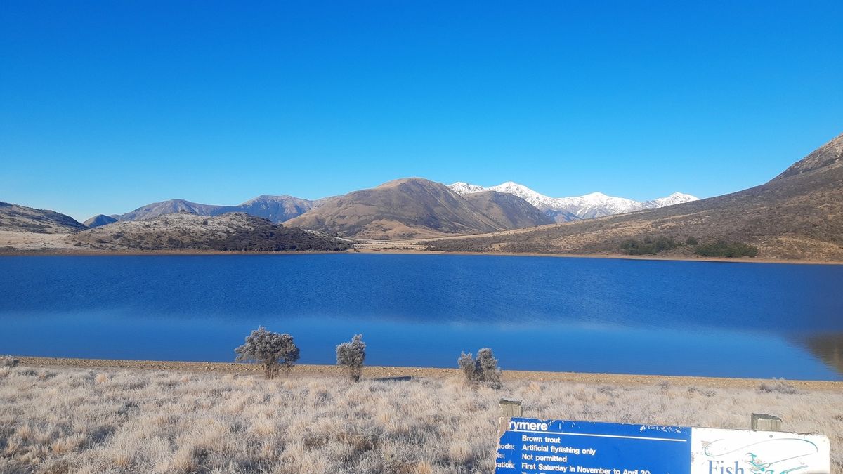
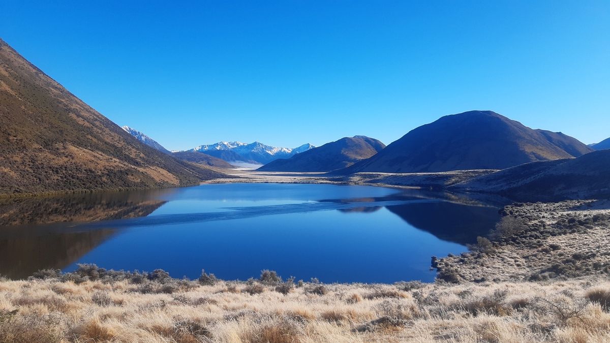
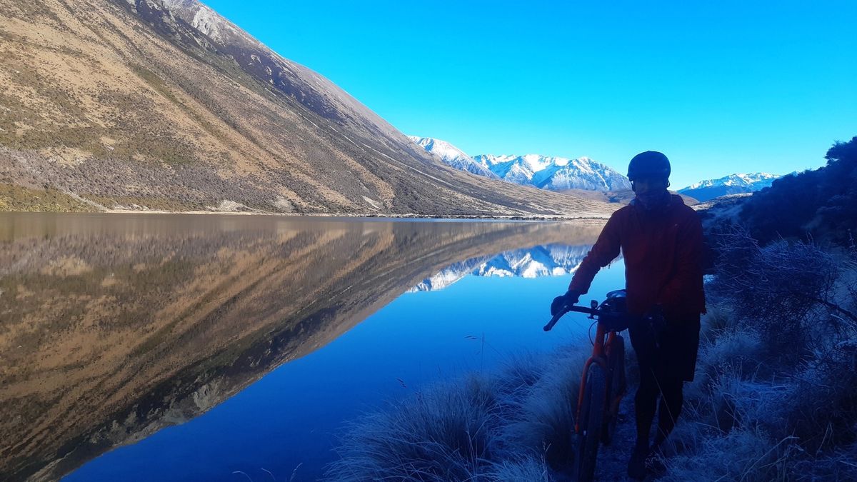
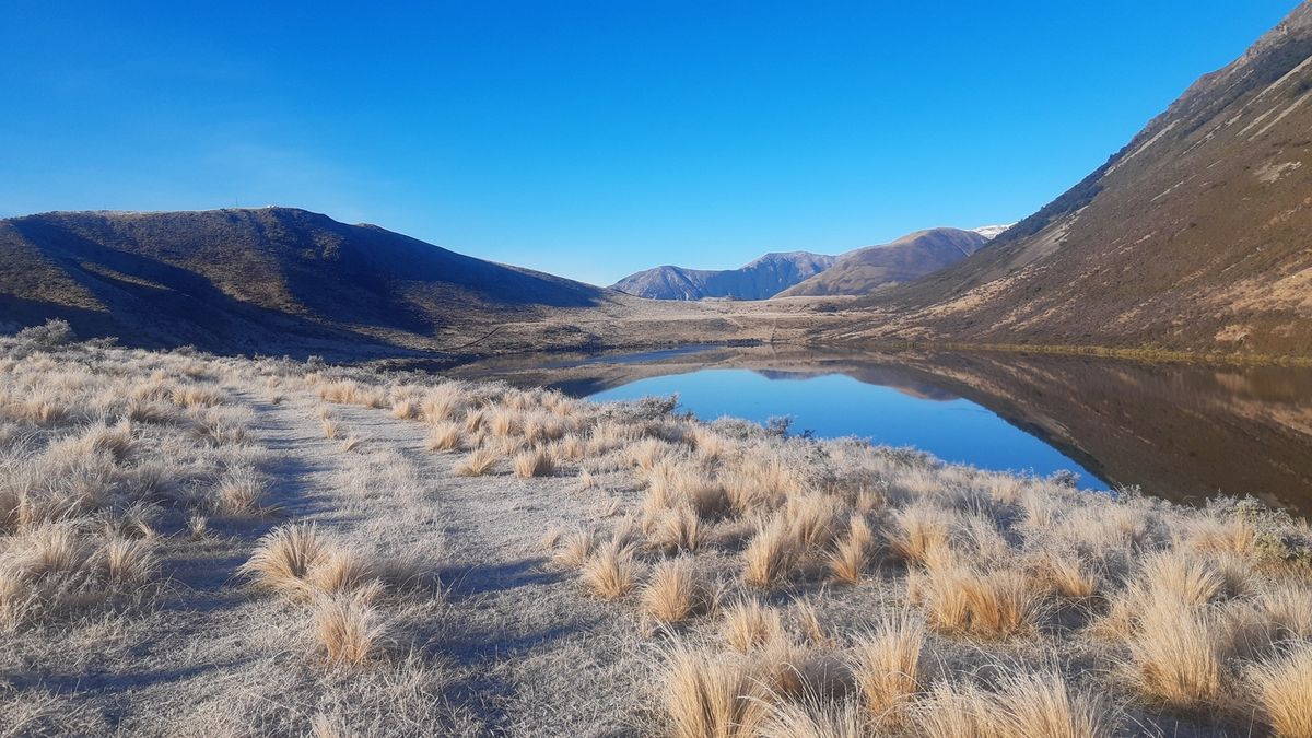
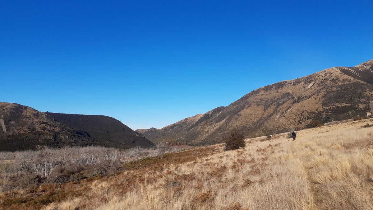
With more photos taken and a couple more gates opened we spotted a sign for a small lake up a short but steep 4wd track. Without much decision we were all up and over the hill to the alpine lake in no time. The reflection in the partially frozen lake was amazing and after a few more photos and simply standing in silence to soak in this insane landscape, discussion soon came back to the route. Although this detour was only 500m away from the main path, a quick look over the map, showed we could skirt the lake, climb a small hill up to another lake, then follow a ridgeline back down to our original path.


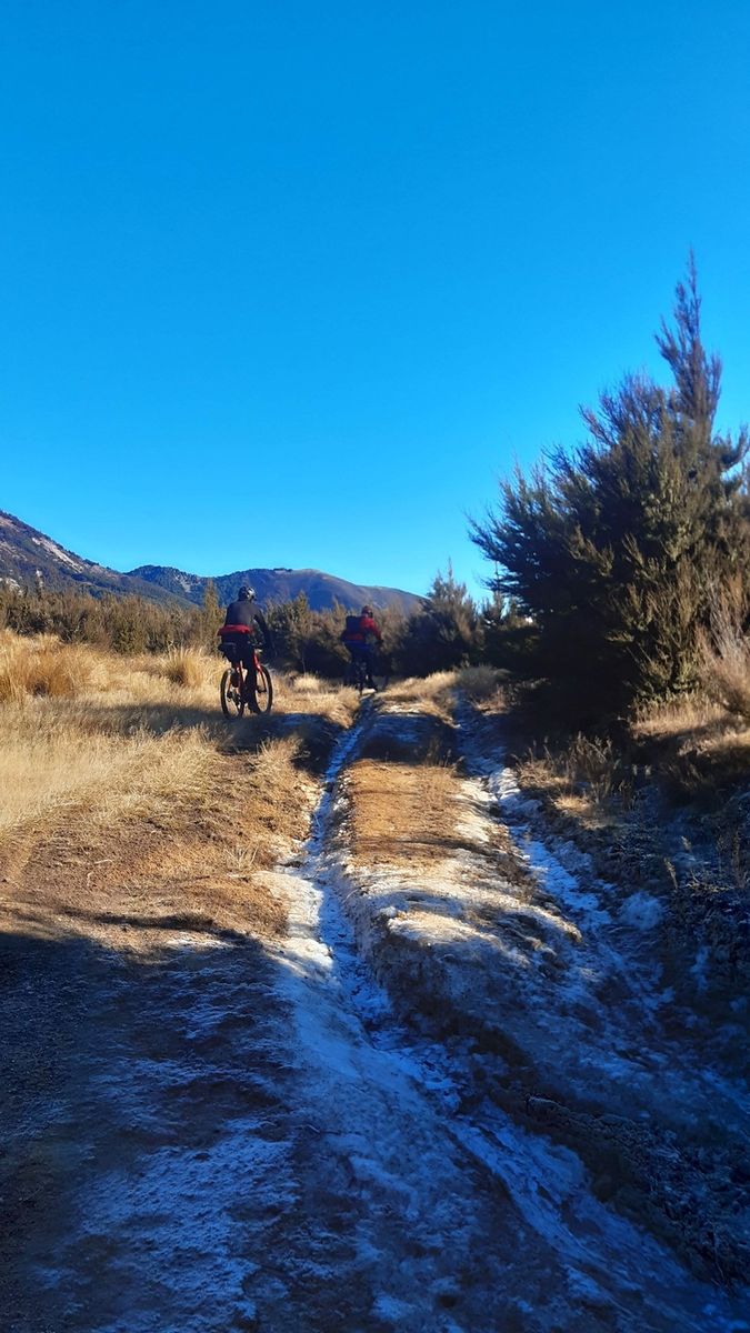
Soon we were slipping our way around a ribbon of tight stock tracks that skirted above the lake. Around the lake we found a freshly bulldozen track (most likely a new fenceline) and after a punchy climb were soon at the second lake. Checking the map again we chose a visible 4wd track on the near ridge, before long we were coasting down a short and frozen descent into a freshly tilled field. At this point it was clear we were about to leave public conservation land and enter a private high country station. So instead we followed the fenceline downhill until we picked up a farm track that sent us directly back to the gravel road.

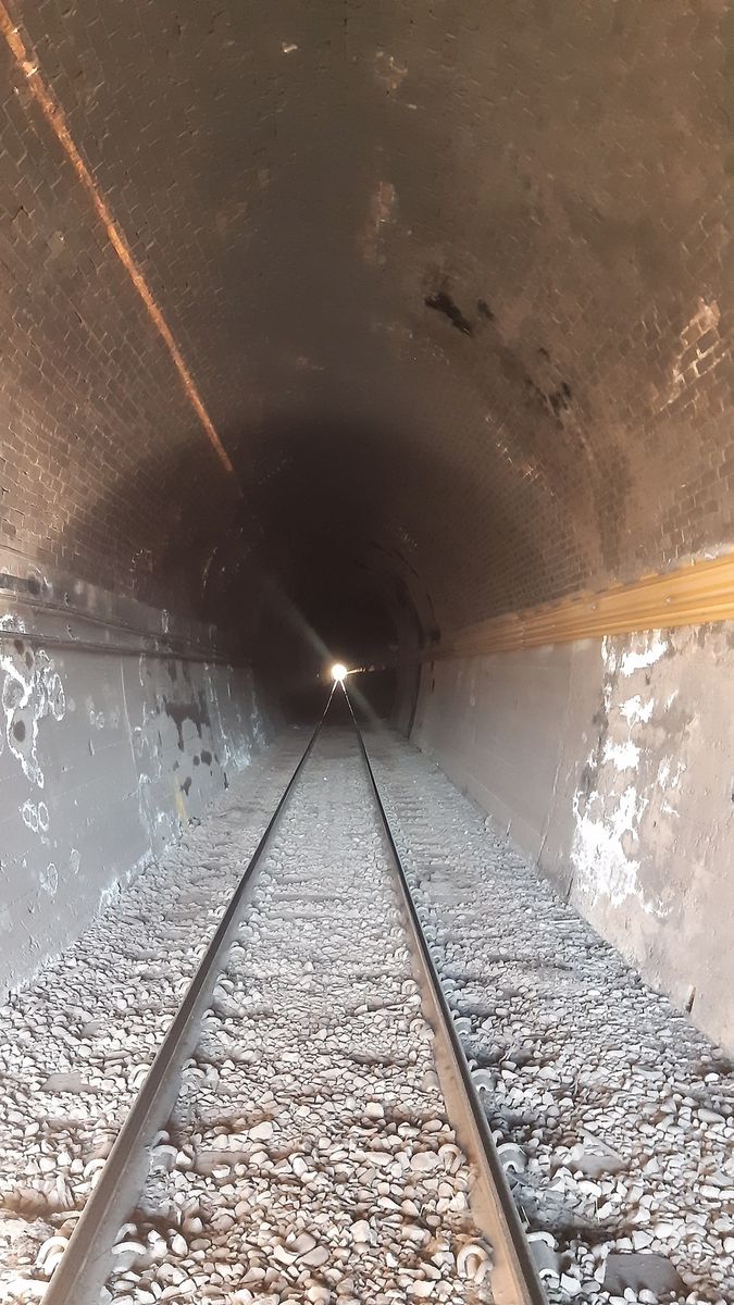
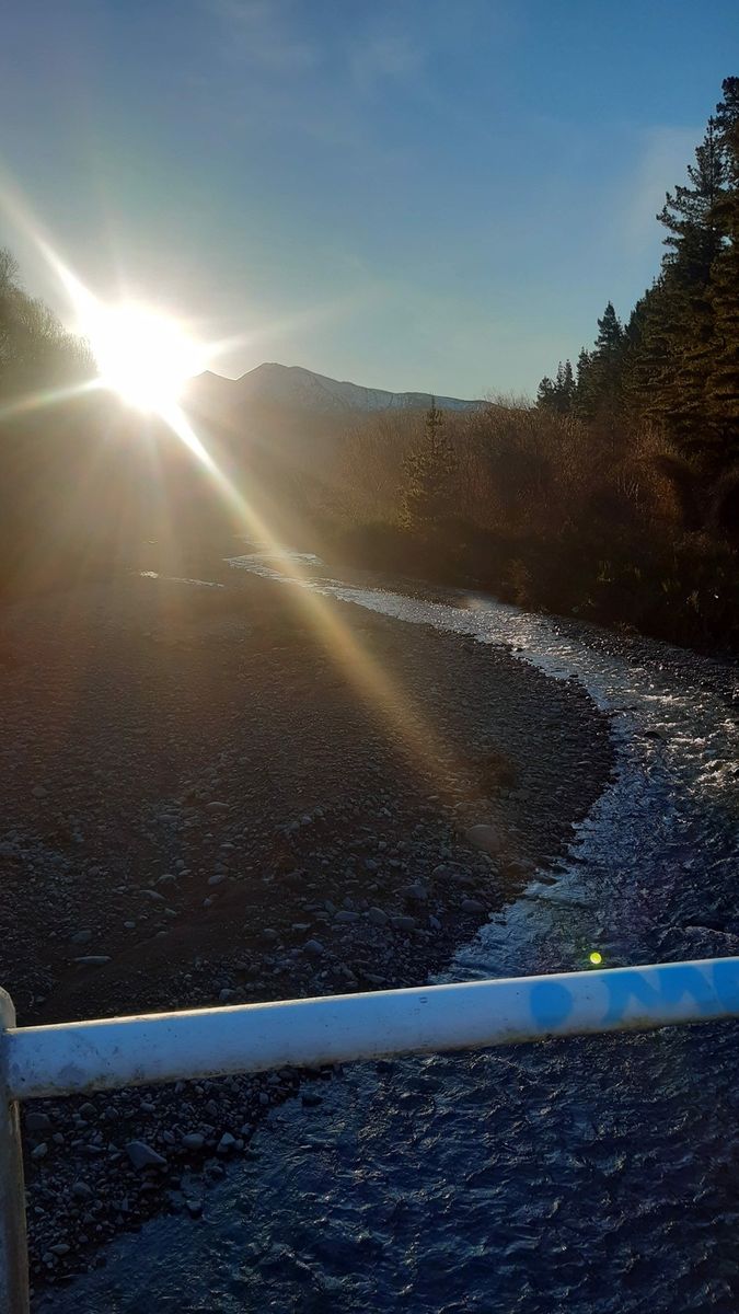
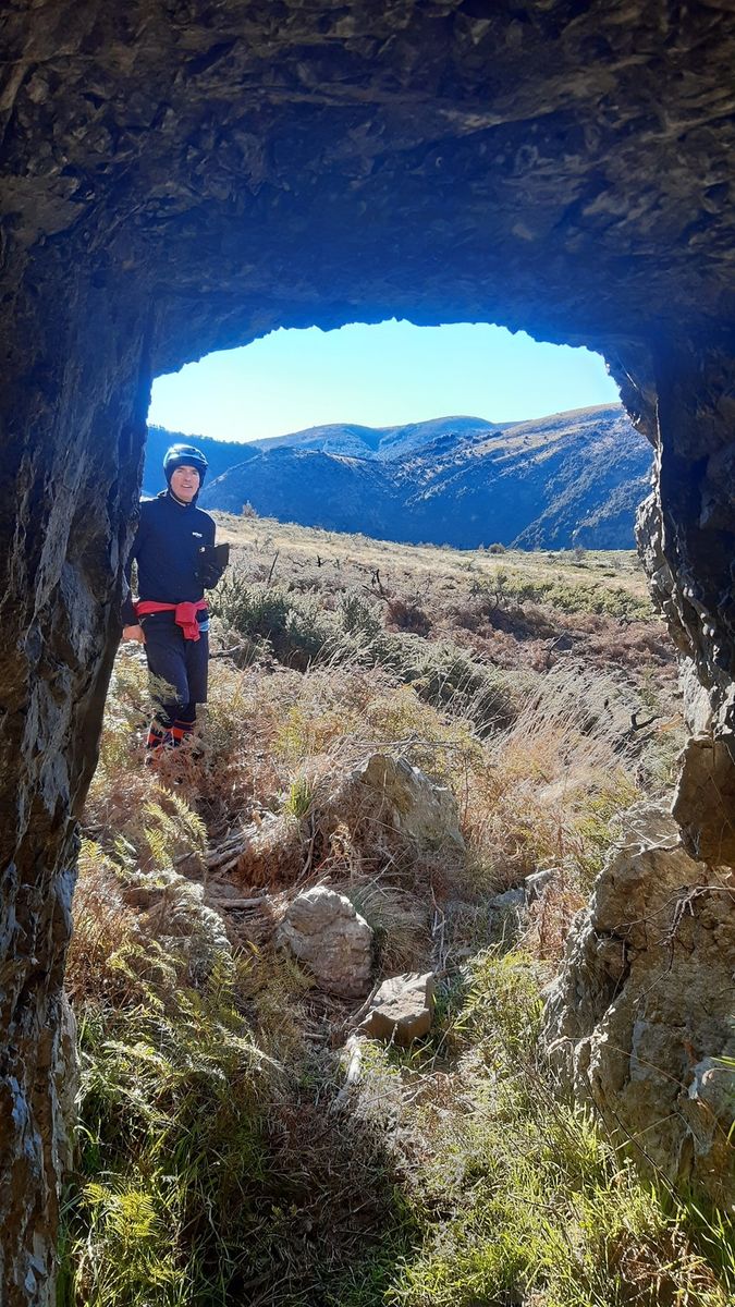
Now back on the main gravel road we cruised down the valley, opening and closing the odd gate until the road ended. We followed a maintenance track a few hundred meters to check out the impressive railway viaduct that crossed the stream and entered into a long and curved tunnel, before backtracking and dropping down the track to the stream. It was evident that the recent record rain levels a few months prior had taken its toll on the track. There were two giant slips to navigate before we rounded a corner and the track completely disappeared. We had 2 options, enter the small but rapid creek or bushwack our way up and around. Being early in the day we chose dry feet and bushwacking.

20 minutes or so later we were standing on the banks of the Broken River contemplating our options.
This was the only crossing of the day and although moving swiftly the crossing was reasonably narrow, with no obstructions and a clear bottom. Being the only crossing I opted for dry feet and removed my shoes and socks, shouldering the bike I entered the river and began crossing. Although swift the bottom was smooth and the flow was only shin deep, UNTIL… I entered the last section of the crossing, within two steps the water went from shin deep to waist, at this point I knew I was gonna get wet but wasn’t too concerned otherwise. My final 3 steps were larger and between each I would float for a few seconds before landing and moving again.


I kept my balance and moved into the shallows on the opposite bank, with only a couple steps to go I trip on a large rock and fall onto my left side. I was quickly up and out of the river, but other than a dry patch on my right arm I was completely soaked. Before I could do anything, I spotted Malcolm entering the water, I tried to yell at him to wait, as the crossing was deeper than we thought, but he was in and couldn’t hear me over the water. I knew straight away that he was approaching the deep fast section so jumped into the river downstream to try and help. Having only just entered the river, Malcolm tripped and within seconds was floating towards me, I grabbed him and pushed him into the bank, with a few scrambled steps he and bike were safely up and out of the river, With the only casualties a lost water bottle and my badly cut up feet :-(
While all this was going on Richard was on the other bank surely thinking about warmer weather. Richard removed some layers, stowed his camera high and dry and shouldered his bike so he could throw it onto the far bank mid crossing. Just before the swift section the bike was ejected and caught on the bank, a couple steps later and a short float he too was across safely. With minimal faff, gear was repacked, some dry clothes swapped on, and before the cold set in we marched on for a sunny lunch spot up the hill. I took a quick side trip to the old Avoca Homestead to have a poke around and take some photos before we slogged up a classic “straight up the guts” farm road to the ridgeline overlooking the valley. Once at the top, the cold river crossing was soon forgotten and lunch was unpacked and demolished. Overlooking the valley seemed an apparent spot for a beer so I cracked one up and cheers’d the beautiful environment we were in.
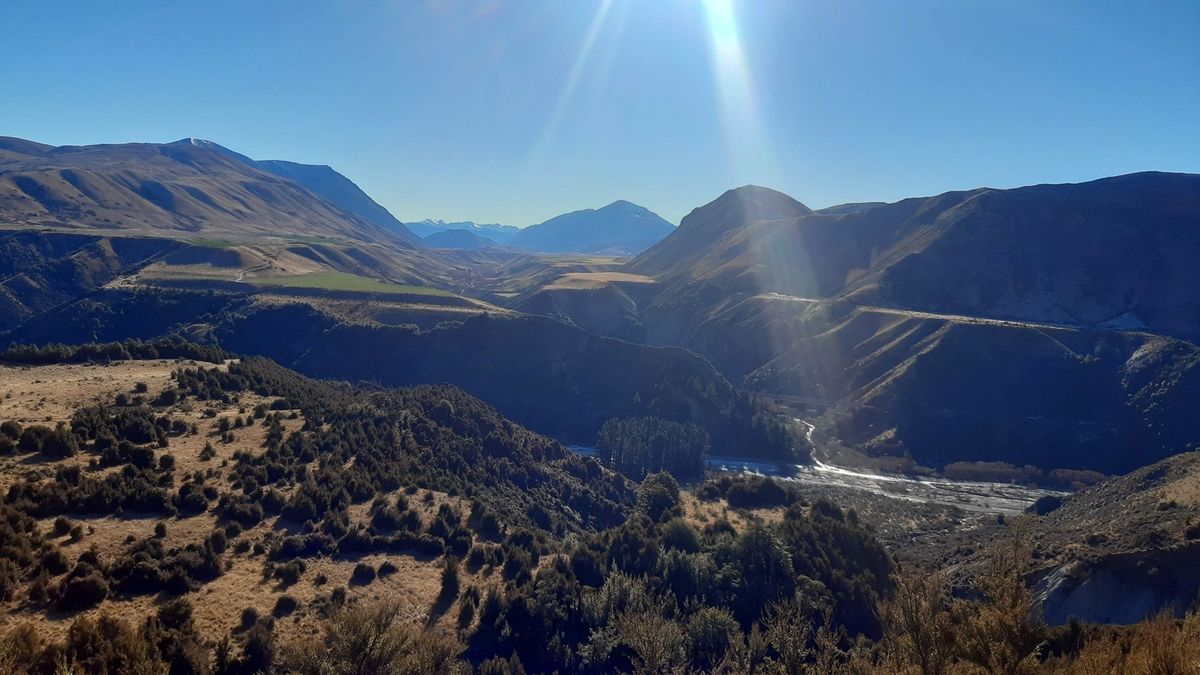
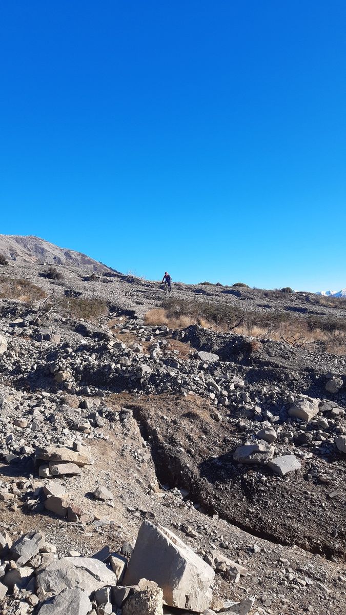
Soon with bellies full and mostly dry we pressed on and followed the old farm road around the hill side, below the towering peak to our right and high above the river to our left. At times the track was washed away by large slips but for the most part the going was good. We soon rounded a corner and the track began to fade into the scrub and alpine tussocks. We’d pick it up for a few hundred meters then lose it into the scrub instead following a single lane animal track, this game went on for a few km’s until the relatively flat plateau ended. We followed a sheep track uphill for a few hundred meters but it dead ended in a creek, after some map checking we could see the track used to go through the creek and up onto another plateau but it was clear that the once clear plateau was now covered in thick scrub (possibly for regenerating scrub after a huge bush fire a few years earlier)
So we decided to cut our losses and head downhill and try connect with a maintenance track beside the train lines. After 25 mins or so of bushwhacking we popped out beside the train tracks. From here it was a nice rolling 20 km’s all the way back to the car. Although the train line followed a nice steady gradient all the way back, our maintenance track would often climb then descent at random like it was created by some sort of roller coaster designer.
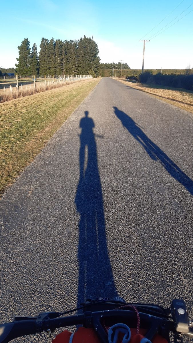
With our shadows long and the sun setting behind the very hills we started in we rolled into Daz’s house, cracked open a beer and celebrated another well spent Sunday.
Words and pictures - Sam Davidson