Sheet 117 – Spring
You may remember I was in the process of using one sheet of Ordnance Survey maps to explore and then highlighting each grid square I had visited, either by foot or by bicycle (but motors do not count!). During the winter, I managed to complete 250 of the 1600 squares of my map.

So how did Spring go?
Spring arrived late, if my memory is correct. Winter (or at least the dampness) consumed a lot of Spring, so motivation was a little on the low side. Once it started warming up I took the opportunity to take in two ride areas that I have not visited for a while.
This is what I love about this project, not so much box ticking as exploring new areas and visiting places that I’ve almost forgotten about. Saying that, I managed to colour in 136 square this season, just over half of the Winter season but I’m having to travel further now to get to the squares.
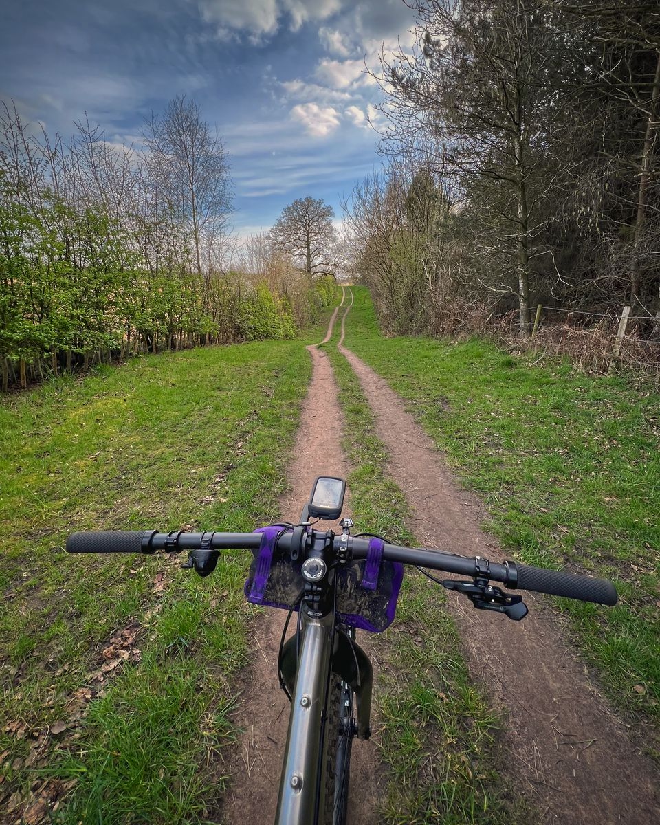
Whitegate Way
Regulars to Grass Up The Middle will be all too familiar with the Whitegate Way but I must admit, it’s been a little while since I’ve travelled along it.
Starting at Delamere Station, I took on Oakmere Way, a lovely 3KM rolling bridleway heading towards Sandiway. Oakmere Way detours around Delamere Golf Club and the Quarries and is surprisingly quiet when you consider how popular the main forest can get.
From Oakmere Way, I detoured south taking in Hogshead Wood. A small sandy wood that has a main path running through it and some singletrack coming off (although it can get overgrown), it’s a great alternative to the road.
From the woods, I entered onto the Abbottsmoss area. Although there appears no right of way, they seem more than happy to let walkers and cyclists through. I circled around one of the meres and found some tight singletrack (so obviously I had to then ride it in reverse and then treated myself to a coffee break overlooking the mere).
It was time to head onto the Whitegate Way and I followed the excellent trail west. The Whitegate Trail is a disused railway, so it’s almost flat, has a smooth service and thus, is extremely popular on the wrong day!
Looking at the map, I could see several bridleways coming off it, so I took the opportunity and popped out by a bar in the middle of a wood! I must have looked confused, as somebody stopped to chat to me. It turned out I had come into the back way to Blakemere Village and rolled into Sandiway Ales pub. I never have much luck and tonight was not going to break that roll, I was driving later on and as such, had to skip a pint or two…
Backtracking (oh the shame) I rejoined the Whitegate Way for a couple of miles before turning off and rejoining the Oakmere Way. The rolling hills (bumps?) nicely finished off the ride and back to the car to enjoy my warm water!
Moel y Caer
This is an area I have not been to in years. My friend used to live up on the hills here and we used to ride here monthly but since he moved, I have neglected the area. Standing at 345m, it is an Ironage Hill Fort overlooking the Clwydian Range. It is one of six hill forts in the area according to Wikipedia.
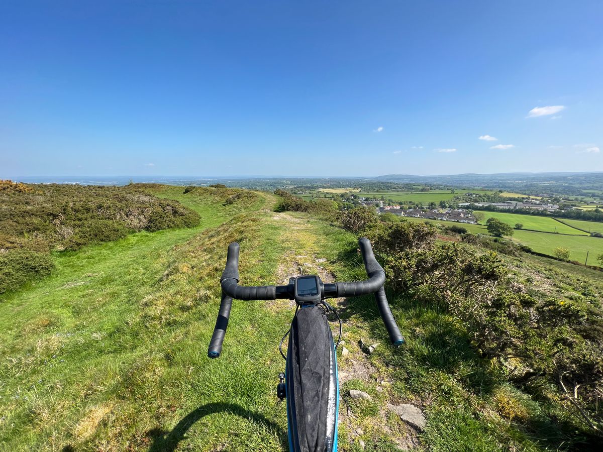
As ever, on a clear day you can see for miles but it can get bleak in the winter. I cycled from home for this particular venture and took in the gruelling climb from The Green in Northop and headed over a couple of 1 in 7 ramps. It’s quite a twisty climb, so it keeps the mind active but it’s narrow too, so watch out for cars (although most travel slow through these roads).
From Moel y Caer, you can head off and explore the Halkyn area. There are some stunning places and some little nuggets of history hidden in the hills, as well as some large quarries too. There are some old Lime Kilns tucked away and is a real treat if you come across them.
Words and Pictures - Simon Bryant